



Southern Ethiopia: A Complete Guide to the Rift Valley, the Bale Mountains, and the Omo Valley
If northern Ethiopia is the country's historical spine — castles, rock-hewn churches, ancient monasteries — southern Ethiopia is something else entirely: a slow unraveling of landscape and culture as you head toward the Kenyan border. Volcanic lakes give way to Afro-alpine plateaus, which give way to the terraced hillsides of Konso, and finally to the Lower Omo Valley, home to one of the most ethnically diverse regions left on the planet.
This is the Ethiopia fewer travelers see, and precisely because of that, it rewards the ones who make the trip. Here's Horn Explore's region-by-region guide to Southern Ethiopia.
The Rift Valley Lakes
Heading south out of Addis Ababa, the road runs straight into the Great Rift Valley — the vast geological fracture that splits East Africa in two — and with it comes a chain of lakes, each with its own character. Lake Ziway is fringed with acacia and a good first stop for birdlife, including pelicans and marabou storks fishing alongside local boats. Lake Langano is the region's go-to weekend escape for Ethiopians themselves, thanks to its reddish-brown but bilharzia-free water, making it one of the only Rift Valley lakes considered safe for swimming.
Nearby, Abiata-Shala Lakes National Park pairs two dramatically different bodies of water side by side — shallow, alkaline Lake Abiata, a magnet for flamingos, and deep, cliff-ringed Lake Shala, one of the deepest lakes in Africa and dotted with hot springs along its shore.
Good to know: This stretch makes an easy, scenic first overnight stop on the way south, roughly two to three hours from Addis Ababa.
Tiya's Mysterious Stelae Field
A short detour off the main southern route near Butajira leads to Tiya, a UNESCO World Heritage Site consisting of dozens of carved stone stelae, some reaching several metres tall and engraved with enigmatic symbols including swords. Archaeologists believe they mark graves dating back around 700 years, but the identity and beliefs of the culture that carved them remain largely a mystery — one of Ethiopia's genuine unsolved archaeological puzzles, hiding in plain sight beside a quiet farming village.
Good to know: Tiya is a brief, worthwhile stop for anyone interested in Ethiopia's lesser-known ancient history, easily combined with the Rift Valley lakes route.
Bale Mountains National Park
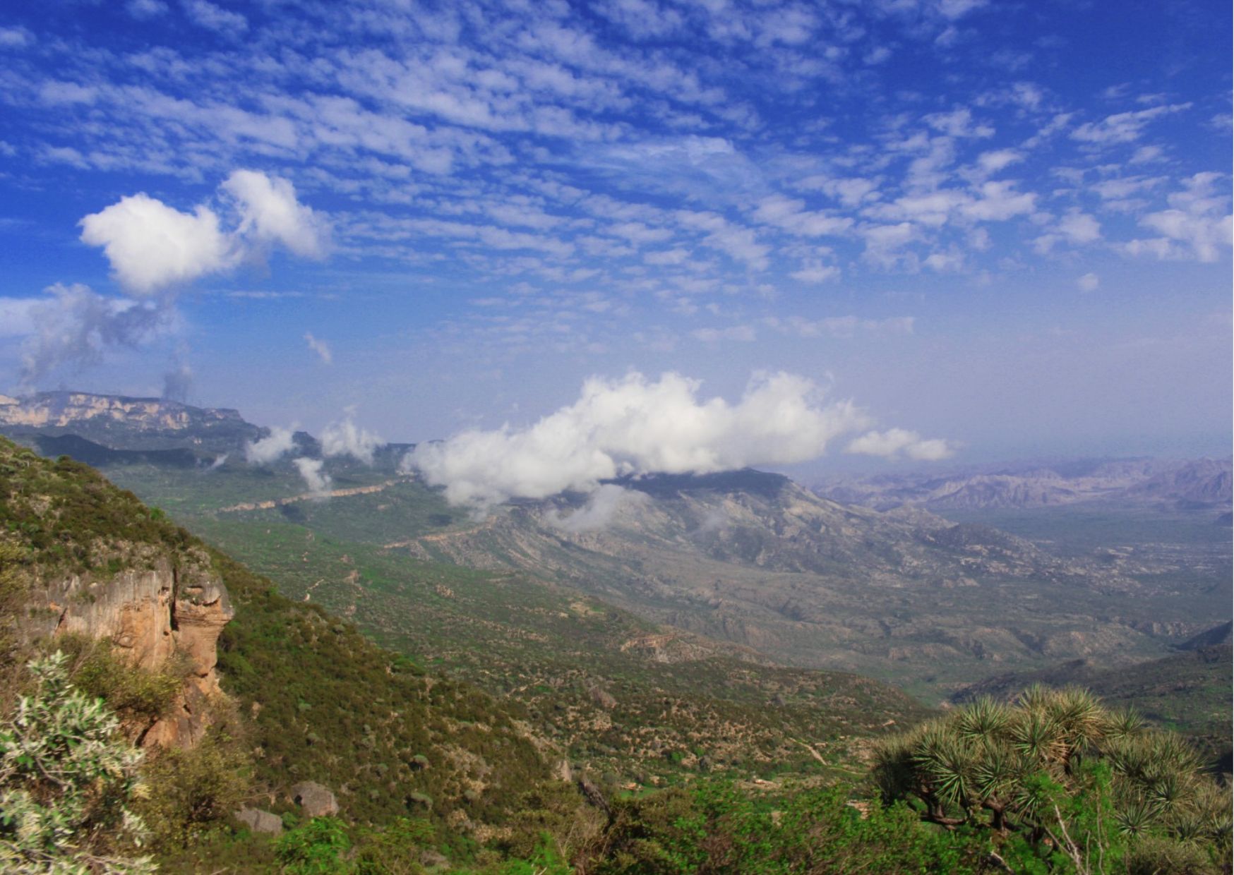
East of the main southern route, the land climbs dramatically into the Bale Mountains, one of Ethiopia's great wilderness areas and a stronghold for species found nowhere else on Earth. The high-altitude Sanetti Plateau, sitting above 4,000 metres, is the most reliable place on the planet to see the Ethiopian wolf, the world's rarest canid, hunting giant mole rats in broad daylight.
Below the plateau, the landscape shifts entirely: the Harenna Forest is a cloud forest draped in hanging lichen, home to elusive lions, wild coffee growing naturally in the undergrowth, and some of the country's richest birdlife. Multi-day treks here range from gentle plateau walks to serious mountain routes, but even a single day's drive across the Sanetti road delivers scenery — and wildlife encounters — most visitors don't expect from Ethiopia.
Best time to go: November to March for the clearest plateau weather and easiest wolf-spotting conditions. Good to know: Altitude is a real factor above 4,000m — build in time to acclimatise, especially if combining the plateau with lowland travel the same week.
Arba Minch and Nechisar National Park
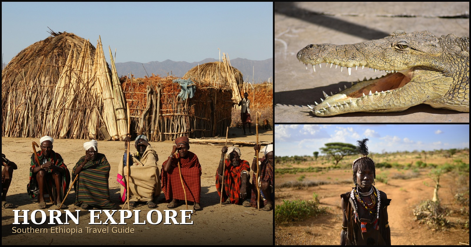
Arba Minch — literally "forty springs" in Amharic — sits on a ridge between two lakes, Abaya and Chamo, with views that rank among the best in the country. Lake Chamo is famous for its outsized Nile crocodiles, some genuinely enormous, easily spotted from a boat trip that also passes hippo pods and fish eagles.
Rising between the two lakes is Nechisar National Park, whose name translates to "white grass," referring to the pale savannah plains that dominate its landscape. Zebra, Grant's gazelle, and, with luck, the endemic Swayne's hartebeest roam here, framed by the so-called "Bridge of God" — a narrow land isthmus separating the two lakes with sheer drops on either side.
Good to know: Arba Minch functions as the natural gateway to the south — most routes toward Konso, Dorze, and the Lower Omo Valley pass through here.
Dorze: Bamboo Villages and the False Banana
A steep drive up into the hills above Arba Minch leads to Dorze, a village built almost entirely around one remarkable plant: enset, or "false banana," which looks like a banana tree but is grown not for fruit but for its starchy pulp, a staple food across much of southern Ethiopia. Dorze's beehive-shaped bamboo houses, some over a decade old and still standing, are woven entirely from local materials and can be relocated, quite literally picked up and carried, when termites eventually take their toll.
The Dorze people are also renowned weavers, and cotton scarves and fabrics produced on traditional foot-powered looms here are considered some of the finest in the country.
Good to know: A visit here works well as a half-day trip from Arba Minch and offers an easy, low-key introduction to southern Ethiopia's cultural diversity before heading further into the Omo Valley.
Konso's Terraced Hills
Continuing south, the landscape changes again at Konso, a UNESCO World Heritage-listed cultural landscape built on centuries of dry-stone terracing that turned steep, unforgiving hillsides into productive farmland. The scale of the terracing is remarkable in itself, but Konso's fortified hilltop villages, connected by narrow stone pathways, are equally distinctive — each built around communal meeting halls called mora, where generational age-sets gather.
Konso is also known for its waka, carved wooden grave markers commemorating notable figures, sometimes accompanied by smaller figures representing enemies defeated or animals killed by the deceased during their lifetime — a striking, distinctly Konso form of memorial art found nowhere else in Ethiopia.
Good to know: Konso marks the last major town before the road splits toward the Lower Omo Valley proper, and its market days are worth timing a visit around if possible.
The Lower Omo Valley
South and west of Konso lies the Lower Omo Valley, one of the most ethnically diverse pockets of land anywhere on Earth, home to more than a dozen distinct groups within a relatively compact area. The Mursi, based mainly around Mago National Park, are known for the clay lip plates worn by some women — a practice with deep cultural significance around beauty and status. The Karo, among the smallest of the valley's groups, are celebrated for elaborate body and face painting created using local white chalk, pulverised rock, and charcoal. The Hamar are known for bull-jumping ceremonies marking a young man's transition to adulthood, while the Banna are recognisable by calabash-decorated hairstyles similar to their Hamar neighbours.
Towns like Jinka, Turmi, Key Afar, and Dimeka serve as gateways and market hubs for the surrounding villages, with rotating weekly markets drawing in Mursi, Banna, Ari, and other groups to trade grain, livestock, honey, and goods — genuine commercial and social hubs rather than tourist performances. For travelers wanting to go further off the map, crossing the Omo River opens onto Omo National Park itself, a remote, sparsely visited wilderness area that feels close to the edge of the known world.
Responsible engagement matters enormously here. Photography is a negotiated exchange, not an entitlement, and travelling with guides who maintain genuine, long-term relationships with these communities is what separates a respectful visit from an extractive one.
Best time to go: Dry season, broadly June to September and December to March, when roads are far more manageable. Good to know: This is a multi-day overland journey from Arba Minch, or reachable faster by flying into Jinka.
Planning a Route South
Most journeys through Southern Ethiopia follow a natural progression: south from Addis Ababa through the Rift Valley lakes, a detour east into the Bale Mountains or straight on toward Arba Minch, then further south through Dorze and Konso into the Lower Omo Valley, before looping back or continuing on to the Kenyan border at Moyale. Done properly, it's a nine- to fourteen-day journey that touches wildlife, geology, ancient history, and living culture in a single overland route — one of the most rewarding stretches of travel anywhere in the Horn of Africa.
At Horn Explore, we build private, fully guided itineraries through Southern Ethiopia tailored to how much time you have and how deep into the Omo Valley you want to go — from a focused week around the Rift Valley and Bale Mountains to a full expedition through to the Kenyan border.
Talk to Horn Explore about planning your Southern Ethiopia route →
Horn Explore — Authentic Horn of Africa Tours & Expeditions.
A note on sourcing
This guide was written independently by the Horn Explore team, drawing on general destination knowledge, our own regional experience, and publicly known historical and geographical facts about each place. It is not a summary or reproduction of any single guidebook or publication.


Comment (0)
Leave A Comment: